Showing posts with label Hammer Nutrition. Show all posts

Sunday, July 2, 2017

The Koenigs Take on the Maine Summer Adventure Race


Handmade awards on tree cookies! HVNC- Hidden Valley Nature Center. Photo Charlie Koenig
For many years, I have been lucky enough to have the unwavering support of my wonderful family as my support crew at my adventure races. They have organized my nutrition, lugged my gear, brought me dry clothes, and cheered endlessly while I insist on putting myself through hours of suffering (the good kind?) at all sorts of events. I have known all along that eventually some day my luck would run out. Some day, they would tire of watching my shenanigans. Some day they would decide they have had enough. Indeed 2017 turned out to be the year in which my support crew of minions would come to a screeching halt. 

Instead, at the starting line for the Maine Summer Adventure 10-hour race, I found myself with two anxious mini-mes and my husband by my side, all decked out with matching team shirts.

This story goes back one year ago when Kate and Cliff White, racers from Strong Machine Adventure Racing, encouraged me to consider a race they were putting on in scenic coastal Maine. Being that the race is the only USARA national qualifier here in Maine, it seemed worth looking into, so I penciled the event onto my calendar. Kate and Cliff, who have a deep love for the sport adventure racing, were hoping to encourage newcomers to the sport by additionally providing a beginner and family friendly 3-hour option that would include Amazing Race style challenges, fun checkpoints, and a great mix of disciplines that could include stand up paddle boarding and/or fat tire biking as well. This sounded like a perfect opportunity to get the kids a little taste of adventure racing! I told Cliff to count us in and invited my family to join me in a Team Koenig adventure.

If you know my children, then you know I never stood a legit chance at convincing them to do the family race. Several negotiations later, including discussions about "not getting in over our heads", breaking up into a girls team and boys team in case one of the offspring decided that they wanted to bail out, I found myself standing at the start like of the ten hour race (OK, sitting in a kayak as it may be) with my husband, 11-year old daughter,  and 13-year old son eagerly awaiting the horn to signal the beginning of their first adventure race.

Teams Koenig Chaos (me and Charlie) and Scrambled Legs and Aching (Dave and Noah). Photo Kate White.

As is the case with adventure racing, you don't know the distances or terrain that you will travel until about an hour or less before the race begins, leaving no real opportunity for planning or race strategizing in the months before. We knew there would be cycling, orienteering, and kayaking- but not the order of the disciplines. I had hoped that the kayaking would be the second stage of the race so that the kids would have an opportunity to rest as needed while Dave and I did the lion's share of the work. But alas, after a little MIA bus driver mishap (which Kate, the RD, at 8 months pregnant, handled beautifully, I might add. I, on the other hand, have a distinct memory of tearful hysteria upon discovery of a bat in my house at 8 months pregnant- a story for another day), we were loading tandem kayaks to push off the shores of Boothbay Harbor for the first leg of the race. One of my CVA students, who apparently works for Tidal Transit as a summer job (who knew?), helped gear Dave and Noah up (thanks Ellison!), and ready we were!! I took this as a promising sign for the day ahead.
Dave and Noah on the Narrows stretch of the paddling leg. Note the curiously open pocket on Dave's backpack housing our stash of honey-almonds. Photo Strong Machine.


Charlie and I making our way along the paddling leg. Photo Strong Machine.


The paddling stage of the MSAR was absolutely gorgeous. I had actually paddled the first mile or two of the race course during a CVA orientation trip, but the scenic coast of Boothbay Harbor never gets old. The foamy water crashing against the rugged, gnarled, metamorphosed mess of bedrock rising confidently from the ocean always gives me a sense of serenity juxtaposed with fear of whatever lies beneath the ocean's surface. While the kids did their part to paddle when needed, this leg was one where we encourage them to drink fluids, have frequent snacks, study the maps, and prepare themselves for the long day that lay ahead. We opted to skip all 3 of the bonus checkpoints during this stage for two reasons. One reason was that due to the late start of the race, the tide would turn around noon which would make paddling against the outgoing tide considerably more difficult. Secondly, we are parents. We know that when kids bonk, you want to be as close to the finish/food/bed as you can be. Bonus checkpoints would be considered only once we felt confident that we had the energy to complete the basic course. We made pretty quick work of the 13ish mile journey through the barrier islands of coastal Maine to the first transition area with only one minor mishap involving a bag of honey almonds and a poorly sealed ziplock just after noon.

The next stage would bring us along a beautiful wooded trail on foot where we aimed to gather the 3 mandatory checkpoints not-so-hidden along the way. As we completed our transition and headed off into the woods, the kids were in great spirits, full of energy, and excited to get underway. Several trails crisscrossed throughout the nature preserve and Dave and I accidentally selected one that quickly appeared to be taking us off course (well sort of- more like right back to where we started). While it was pretty clear that Noah was beginning to question the competency of his navigators, he let us off the hook without too much ribbing. In hindsight, he shouldn't have gone so easy on us because it turned out that we had an insert map for this section of trail in our pile of maps that we didn't notice until after the race. Um, oops.

We encountered many of the same teams over and over during this stage, which made for some fun camaraderie on the trails. Some teams made wrong turns where the trail was less traveled. Others left the trail in search of scattered bonus points hidden in the forest beyond the safety of the trail. One thing I really appreciated about this race was how incredibly friendly, easygoing, and just plain awesome the volunteers, spectators, race directors, and other racers were. Everyone encouraged the kids and seemed happy and cheerful themselves. It may seem like a silly point to make, but the reality is that not all race experiences are like this. Race environments can be stressful and can bring out the worst in people (even race directors). I think the people are what make this race exceptional.

Orienteering at the Dodge Point Preserve. Photo Strong Machine


We made our way steadily along, noting that we were continuing to make better time than we had anticipated. It was then that Dave and I broached the subject of possibly gathering a few bonus checkpoints in order to be more competitive in the field of racers. It was becoming clear that if we collected only mandatory checkpoints, we would arrive at the finish with at least two hours of unused time (the rules state that you can not return to completed stages- nor would you want to in a point-to-point race such as this). We opted to collect bonus checkpoint "E" that seemed to be a pretty straightforward: we could get to within a short distance of the checkpoint via a old, overgrown road and then shoot for the "summit" with a bearing. (Of course, this would have been even easier if either of us looked at the map insert provided that included trails, rock walls, and other benchmarks not on the maps we had). Charlie gladly went along with the plan, thrilled with the idea of snagging the extra point. Noah, on the other hand, expressed reservations and I could tell that for him it required a huge leap of faith. He knew that we might not find this hidden checkpoint, and Noah isn't much for risks. But, he was feeling good and succumbed to the badgering from the rest of his family and went along with it anyway. His risk was rewarded with a well-hidden orange orienteering flag, 4 sour gummy bears, and a pretty solid downpour of rain.

Devouring our supply of Ensure, gummy bears, Hammer Bars, pop tarts, and seawater-soaked honey almonds (Ok, only Dave was brave enough to eat those. There is a reason that this man is my hero), we approached the next transition to stage 3 at the beautiful Dodge Point Preserve. Our intention was originally to skip the entire stage since it included only bonus on-foot checkpoints. Having arrived ahead of schedule, we decided that we might consider grabbing one or two checkpoints if they appeared to be low-hanging fruit (maps for this stage were not available until arrival at the preserve). Upon reviewing the maps, we decided that we would attempt to gather bonus checkpoints L and M, which would require less than a mile of bushwhacking to obtain. We decided we would give no more than 30 minutes to the effort. Without difficulty, I was able to lead us directly to CP "L" (sorry Dave, you were wrong on this one). From there we covered some funky terrain on the approach to CP M. The faint topographic lines on the Dodge Point map, combined with some funky shadowing and lots of zig-zagging lines made it difficult to see exactly what we were looking for, but it appeared that the CP would be in a little hollow between two little ridges in the topography. After finding the hollow and no CP even after scouring the surrounding area, the search for CP M seemed to fruitless. The kids were anxious to get off of their feet and onto their mountain bikes and another team we encountered was equally frustrated. Dave and I learned last summer that sometimes you just need to let some elusive checkpoints go after spending 2 hours searching for one particularly difficult one that we never did find, so we made the call to give up on this one. Seconds later, Charlie's triumphant squeal of "I found it!" resonated throughout the forest. Checkpoint M, just so you know, you've got nothing on our 11-year old daughter.

Stage 4 was a biking stage that would take us through Damariscotta Mills, along single track behind Oxbow Brewing Co. and tasting room (where Dave was longing for a pint), and into the Hidden Valley Nature Conservancy. In another small-world twist of fate, the location for the bike drop and transition into stage 4 was on the front lawn of another one of our CVA students. We arrived to discover that sometime during the morning hours, every bike was adorned with a Snickers bar waiting for the weary riders to emerge from the forest. It was the perfect timing for a little transition magic and made the kids feel really special  (thank you Manahan family!!).

The ride to the conservancy was as great as the Snickers bar surprises (not gonna lie, I ate two). Fun hills, fast riding, and a stretch of new single track (which was another bonus CP) kept us entertained as we grabbed checkpoints and made our way toward Hidden Valley Nature Center. We are pretty sure both Noah and Charlie might have violated the 30 mph speed limit on a descent that elicited whoops and hollers from all. We probably also left a few roadside cows a little confused. We arrived at HVNC with around an hour to spare, and after inhaling some delicious pieces of watermelon at the transition, we headed out for bonus points Q and R on our mountain bikes. It was while looking for the CP R that it became clear that 10 hours of adventure racing would be just enough adventure for teams Koenig Chaos and Scrambled Legs and Aching. The final CP, cleverly hidden beneath a footbridge, nearly left us empty handed.

Charlie and I coming in for the finish. Photo Strong Machine 
As we dropped out of the conservancy and back on to Egypt road for the final mile toward the finish, I really enjoyed the opportunity to ride behind my kids as they completed one of the most difficult physical challenges of their lives. With each stroke of the pedals, their sense of accomplishment was evident. Noah disappeared out of sight as the finish line neared forcing the three of us to pedal harder to keep up.

While on the outside, adventure racing might seem like only a race. On the inside, it is so much more. We are reminded that together, we are a team. We are reminded to trust one another, support one another, and take care of one another. When things get difficult, we have one another. I am so grateful to be able to experience this with Dave and the little people in our lives. I can only hope that the kids will apply this to other areas of their lives and remember that no matter what happens, we are all in it together.


Charlie and I receiving our awesome tree cookie plaque for first place female team with Cliff and Kate White. That is one suprirsed, happy kid.
Photo credit: Strong Machine Adventure Racing

Thanks to Kate and Cliff at Strong Machine and all of their great sponsors for putting on this awesome event (and for the photos!)! Also, thanks to Hammer Nutrition and Spandits for their unwavering support over the years (click on the sidebar of my blog for discount codes from these two great sponsors)! We'll see you at the next one.

Tuesday, August 9, 2016

Scrambled Legs & Aching and the Bitter Pill


It has been said that getting lost will help you find yourself... Photo  GMARA..

My husband Dave has been the best supporter of my adventure racing lifestyle over the last several years. Kid duty, photographer, race crew, tolerator of all things... just to name a few. I have tried many times to convince him to join me, but it wasn't until this year that he finally conceded. And just like that, team Scrambled Legs & Aching was formed for the 12-hour GMARA Bitter Pill Adventure Race held at Bolton Valley, VT.


Looking a little terrified during our pre-race official photo. At least we are in it together. Photo GMARA

Both Dave and I have a fair amount of experience in the disciplines of sport that would be included in the Bitter Pill. We are both experienced paddlers, are avid hikers, and ride mountain bikes all summer (admittedly, Dave much more enthusiastically so than I). We were both also well-prepared for some swimming or a ropes component, but those would not end up being part of this year's event. Orienteering, on the other hand, is an area where we are both inexperienced. I mean, I have watched other people navigate using a map and compass for whatever that is worth. Successfully navigating to the required checkpoints using a map and compass while biking, hiking, canoeing, etc. could prove to be an incredibly interesting challenge. There would be a good chance that much of our day could be spent lost in the woods. So, at 4 AM, we showed up at the pre-race meeting with our gear packed and compasses slung around our necks ready to learn what our fate would be.

The race began with a 35-minute bus ride in the darkness to the start location. At 5AM, we were led to a field of canoes and kayaks (with no water source apparent anywhere), handed our maps (made from data 30 years old), and instructed that all racers who arrived at the finish after 5PM would face a checkpoint penalty in accordance with how many minutes late they arrive. There was a loud and clear message in that directive: DON'T BE LATE! I wondered if we should just start looking for the finish now...

A cool photo of team Strong Machine snagging a
checkpoint on the paddle. photo GMARA

With first light illuminating the sky, we portaged our canoe overhead toward the first checkpoint about 1km away. We scrambled through long grass, over a barbed-wire fence, and finally roadside toward the muddy put-in on the Winooski river, which was running unseasonably low due to the dry summer conditions. The paddle to the first few checkpoints began in a pretty uneventful manner, and Dave and I settled in and started thinking that perhaps it was going to be a good day. The reality is, that things are never quite that simple. Not two seconds after Dave commented how his paddle was feeling unusually flexible in the water I heard the unmistakable crack of plastic snapping followed by several expletives from Dave. Gleaning over my shoulder, I could see there was clearly a problem; Dave only had 1/3 of a paddle blade attached to a cracked shaft. In all fairness, the paddle now made an excellent pole to push the canoe over the shallower sections of river. With a cracked shaft already, this didn't seem like the smart thing to do, however. So we paddled on, with the blade of Dave's paddle sounding like it had a sneaker attached to the end each time it punched into the water. Kerplunk, kerplunk, klerplunk. As the early morning fog hung low over the the river, the stillness only broken by the riffles of the current, we forged on, a little embarrassed that we were the only team of over 50 that managed a broken paddle in the first kilometer of the race. Kerplunk, kerplunk, kerplunk...
Paddling down the Winooski. It appears that we still have two complete paddles at this point in time. That portage totally destroyed my braid, but the way.  Photo GMARA

By the time we reached the next portage around a large dam at checkpoint #3, the race directors had caught wind of the rumor that a couple of suckers were paddling a canoe with only half of a paddle and a new paddle was ready and waiting. I began to wonder if we told them that we were missing a qualified navigator, they would have provided us with one of those too? I forgot to mention (yeah, forgot, let's go with that), that we missed the third checkpoint during this portage and had to run back to punch our passports.
Here is a funny picture of me trying to make sure that Dave stays up on his nutrition by forcing him to take his Endurolytes and Endurance Aminos. Eat it!! Photo GMARA.

The next several checkpoints were easily found along small tributaries, islands, or footbridges along the Winooski River. I was really grateful that they were all pretty easily navigated to, because paddling upriver for a missed checkpoint would be a real bugger. It was actually a beautiful and enjoyable paddle, and we arrived at the first transition area feeling great and in high spirits.
Punching CP #6 on the footbridge of the Long Trail. Ironically, Dave and I spent hours lost on the Long Trail with the kids near Smuggler's Notch this winter. We have since re-named it the Wrong Trail. Photo GMARA
TA 1 waiting for racers to arrive. Photo GMARA

The next leg was a mountain biking leg consisting of a small amount of paved road, to gravel road, to trail. We started out with a navigational mishap early on in the leg (oops, missed a turn), but found the checkpoints without too much trouble after that. This leg was around 27km in total- my estimation is that at least 24km of the leg was climbing (and lots of hike-a-bike). You might think this is impossible... that exaggeration is in my genetics.... I'll deny it. It IS entirely possible. Having just converted my mountain bike drivetrain to a 1X, I was definitely missing the existence of true grandma gear for the steeps. Let me tell you, that downhill was pretty exciting though (I might have yelled yee-haw once or twice, but I'll deny that too).
Headed out of TA 1 on the beginning of the bike leg. Photo GMARA

Dave on his way out of TA 1 Photo GMARA

We rolled into the second transition area (best guess at 11:30 am), dropped some gear and took a few minutes to plan our navigation for the next leg of the course. While the paddling and biking legs required checkpoints to be collected in order, this section was an orienteering section where eight checkpoints could be collected in any order. We made a plan to punch checkpoint (CP) #13 first and them make our way up the mountain to collect the checkpoints along a ridgeline and summit route afterward. We departed with Kate, Cliff, and Grey of team Strong Machine who were headed to the same checkpoint in search of a tributary intersecting with the drainage of Joiner Brook. We chatted along and probably were a bit distracted just long enough to
Headed out to CP #13 from the transition area with team Strong Machine.
Photo GMARA
misinterpret the scale of the map (which was made using 30-year old data), putting us further upstream than any of us realized.  After about 30 or 40 minutes of scouring several drainages (both dry and with flowing water), we all agreed that we were not near the checkpoint. Dave and I returned to the transition area and re-thought our scale, and resumed searching for drainages that appeared to match the drainage shown on the map further downstream (here is where I remember specifically being told not to rely on river drainages for navigation by one of the race directors the night before). Having lost nearly an hour, we decided on a different approach. We decided that we would not look for the drainage from the brook, rather we would take a bearing from a snowmobile bridge that seemed to appear on the map. We followed the bearing, only to wind up in the exact spot where we had been 20 minutes earlier. Still, no sign of the orienteering flag.


Here is a Google Map of CP #13. The CP was shown on our map (looked like this one, but much smaller scale) to be a little ways up the drainage shown as the southernmost E-W drainage intersecting with Joiner Stream. This is also likely based on 30 -year old data.


Here is a current GoogleEarth image- same scale. The drainage doesn't appear to be here at all any more. Furthermore, the character of the river is also entirely different from the GoogleMap above. I blame hurricane Irene for this chaos. That is my story and I am gonna stick with it.
Here is one reason to always question streams shown on 30 year old data.

Here is what I have learned that has been confirmed by other adventure racers since then: some check points just aren't meant to be found. At least, not by us. At least not on this day. Our difficulty on this day was that we weren't willing to admit that. Two hours later, we returned to the transition area once again, empty handed, baffled.

We now had around 3 hours remaining to search for checkpoints on foot before getting back on our mountain bikes for the final leg of the race. All of the checkpoints in this section were complete bushwacks- no trails, no significant drainages, and in most places the foliage was so thick it was difficult to see benchmarks like mountain tops or ridges. We decided to reverse our plan and approach the checkpoints in the opposite order, beginning with CP #14 and climbing the mountain from the other side, gathering as many as checkpoints as possible in the allotted time. The climb was steep, the vegetation thick (thanks for the souvenir, poison ivy), and the navigation was challenging, but we collected 4 more checkpoints in the next two hours. After a particularly thick section of bushwhacking reminiscent of our search for lost AT thru-hiker, Gerry Largay, in 2013, we approached checkpoint #18 around 3:15pm. After a pretty hasty search, we made the difficult decision to abandon the search for the checkpoint to return to the transition area, hoping to gather CP #19 on the way down the mountain. There would be no sense snagging checkpoints only to lose them in a penalty for arriving to late to the finish line. Unfortunately, as luck would have it, neither of those checkpoints would be punched on our passport either.

Nothing like rolling up to a finish line in grandma gear on the bike. I suppose that is better than pushing it though, right? Helmet with a hat? Really it IS a thing. Photo credit: GMARA

We made it to the transition area and hopped back on our bikes to ride up to the finish, collecting the final two CP's on the way up. It turns out that a volunteer at the transition area had given Dave a map that would show the current location of nordic trails that we needed for the remainder of the course. That map somehow never made it out of the transition area with us. Oops- rookie mistake #5 (or is that #6- but who is counting?). Luckily, the larger, older map would suffice since the journey was not too tricky (just peddle UP). All in all, we could collect 17 of the possible 21 checkpoints along the way and finish with 15 minutes to spare.

Maybe there was, after all, time to go back for CP #13? Not a chance.

Team Scrambled Legs and Aching at the finish after a great day of racing. Photo GMARA.
Thanks to the ladies at Spandits! (check out their awesome new prints! If you use code SPANDITSLOVE and tell them I sent you you'll receive 10% off your entire order). Also a shout out to the great folks at Hammer Nutrition (use this link to Hammer Nutrition for 15% off your first order) for fueling us through another great adventure. We felt great all day thanks to Hammer's awesome fuels (Heed, Sustained Energy, Endurolytes and Endurance Amino).

Finally, thanks to Shawn, Chris and the volunteers at GMARA for putting on an amazing event and generously letting me share their photos!

Tuesday, April 19, 2016

50 Years of the Kenduskeag Stream Canoe Race

Lani and I at drop 2 of Shopping Cart Rapids. Justin Russell Photography


One of my favorite things about competing in different events is what I learn about the event's history and the people, culture, and communities that host the event. This weekend, I had the privilege of being one of nearly a thousand participants to take part in the 50th annual Kenduskeag Stream Canoe Race. In lieu of a lengthy race report, I think that a few interesting facts about the race and some great photos will suffice. This race speaks for itself, and a good picture says a whole lot of words!

Kenduskeag Stream Canoe Race tidbits: (if someone has additional tidbits or photos, please let me know, I'd love to add them!)


  • First run in 1967, the inaugural race was put on by Sonny Colburn and Lew Gilman.  There were 32 canoes and fifty thousand spectators. No, that is not a typo. Reports suggest that seven of the boats never made it to the finish. Sonny Colburn was present at the race this year to kick off the 50th anniversary of the race.


  • The Kenduskeag Stream Canoe Race is the largest canoe race in New England. Over the event's history, over 30,000 paddlers have participated. There were participants in attendance who have raced the event more than forty times. 


It is astonishing to see what thousands of people in the tiny town of Kenduskeag (population of about 1,300) actually looks like.


  • The race covers a 16-mile stretch of the Kenduskeag that includes 9 miles of flatwater and 7 miles of class I to III whitewater with two mandatory portages (and one optional at 6-mile falls).


Lani and I making our way down the Kenduskeag. Photo Chip Cochrane.


  • Canadian kayaker Trevor MacLean won this year's race in a field of 493 boats (921 participants). This is his 12th win, tying for the record of most times won.


Trevor MacLean paddles one of the narrow, sleek kayaks seen on the river. 
My guess is that most of these fragile boats portage the 
bigger rapids.
Photo Michele Barker Photography.


  • Not all competitors are as serious, however; many teams come dressed in costume. The Gumby boat, for example, has been paddling the Kenduskeag since the early 1990's and was once featured in Sports Illustrated. We also saw Minions, Ghostbusters, zombies, superheros, bananas, ducks, and bubble machines traveling downriver. Some folks come to the Kenduskeag in traditional canoes ("recreational boats"), others kevlar race boats, and some war canoes.

I am pretty sure when we passed these gals, Lani yelled "who ya gonna call?". How original. Photo Whittling Fog Photography

I have no idea how the guy in the stern can see over Gumby. Lani complains about not being able to see over my big head. Photo Michele Barker Photography.


  • The best place for viewing the carnage is at six mile falls, but by no means is this the only place where boats flip. In 2010, Hank Garfield of the Bangor Daily News did an informal count of vehicles of "river vultures" (a term used for spectators who follow the race by car to watch the carnage) at six-mile falls. He quit counting at 700 vehicles. Another popular viewing spot for river vultures is the rapid known as Shopping Cart, named aptly after several shopping carts mysteriously appeared on the riverbanks several years ago.


  • WABI also covers the carnage on channel 5 for those who can't get out to watch the fun. This includes a full two hours of coverage from six-mile falls. My children were glued to the event from home.


I love this sequence of these two fellas trying so desperately to stay in their boat. I am not sure how things ended up for them, but I think I have an idea. It is worth noting that many people who take a dunk in the river get back in pretty quickly and put in a solid finish time.
 Photo Michele Barker Photography.


  • I attempted to uncover statistics on the Dump Rate, DNF statistics, or some data on lost/destroyed boats each year. Obviously, data would vary depending on flow conditions, but it turns out, that there is no such data. On this search, I got distracted on a 2007 lost-and-found thread where people were posting information regarding lost boats. I stopped after reading about at least twenty lost boats from that year.

I can honestly say, I have never seen this before. Whittling Fog Photography

A z-drag rescue for an unlucky boat wrapped around a rock below six-mile falls this year. This would be an example of how people DNF this race. Photo Michele Barker Photography


As for our part, Lani had an awesome run this year! After losing our division in 2014 by a margin of just 31 seconds, we came ready to put it all out there. Putting in the 18th fastest time of the day (amongst all crafts- first in our division), we had our best day paddling yet!


Thanks Michele Barker photography for a cool action sequence of Lani and I in the final drop of six mile falls. I always look so serious in these photos. Photo Michele Barker Photography.

Super big smile for an awesome effort. The wooden canoes are the coolest prizes of any race! Photo Lani Cochrane.
Thanks to Michele Barker Photography, Whittling Fog Photography and Justin Russell Photography for catching fun action shots of the event. Also thanks to Hammer Nutrition (use this link for 15% off your first order) for great fuel and Spandits for my awesome tights and hat (use code SPANDITSLOVE and tell them I sent you for 10% off)!
This is my "I wish I wore a visor" game face. Whittling Fog Photography


Monday, April 11, 2016

Round 3 - The 2016 Tuckerman Inferno Pentathlon.


A racer headed over the headwall in the 1939 Tuckerman Inferno. Photo Winston Pote.

"The first time you do something it's science. The second time it's engineering. The third time, it's being a technician. I am a scientist. Once I do something, I want to do something else."- C. Stoll.

Those who have raced with me know that I'll try most any race one time. If it seems like an adventure and there are good people there, why not? A second time go at the same event? Maybe. Unlikely. Unless it is pretty awesome. There are only a few events that have made this standard. Truth be told, most events aren't as much fun the second time around, particularly the difficult ones. Once the sources of suffering are known, the Fun-O-Meter never reads as high for me. A third time? Well, never. I simply don't do that. 

Until this weekend, that is. This weekend's Tuckerman Inferno Pentathlon will be the first time I've had a go-around with the same event three times (in a row even!). Here is the thing about this race; every year it brings something different. In a nutshell, the event consists of a 8.5ish mile run, a 6-mile whitewater kayak, an 18-mile bike ride, a hike up Mt. Washington, and a climb and ski somewhere in Tuckerman ravine. My friend Ken Lubin, who has done this race over a dozen times, agrees that no two years are ever the same. Variable ski conditions in avalanche terrain, river levels, and the challenges that mother nature conjures up ensure that you can always expect the unexpected. 
A little final warm up before the start. Cozy and
 warm in my Spandits!- Dave Koenig photo.


So, despite my love 'em and leave 'em ways with races, I found myself rolling out of bed on Saturday morning (way too early) to hit the starting line at the crack of dawn, ready to start my 3rd Tuckerman Inferno (yet, no less nervous at all).

Of all of the legs, the run leg is the most predictable. For me, predictably difficult. Having struggled with plantar fasciitis for the last two years, I can no longer describe myself as a runner. In fact, I can no longer describe myself as someone who likes to run. Unfortunately, as I have experienced in other years of the Inferno, everyone else on the starting line IS a runner. Those participating in the running leg of a 5-man relay team have identified themselves, above other things, as the team's runner. The other Elite athletes (Elite is the term given to those competing in all 5 events), as I have learned, are no less of runners, they just aren't ready to stop when the running leg is over. Where, might you ask, are the middle-aged off-the-couch weekend warriors that make up 75% of the pack for most road races? They are still home, snug in their beds. There is no back-of-the pack at the Inferno. 

In the first three miles of the course, over a mile of it is straight uphill, gaining 600 feet in elevation (which feels more like 6,000 feet first thing in the morning). I generally like hills, so the first few miles are somewhat pleasant for me in a masochistic way. Where I run into trouble (no pun intended) is the downhill sections. My knees and feet detest the pounding of long-strided downhills, so my cadence is reduced to small shuffling steps. Waves of runners flock by me while I am helpless to keep pace. The miles go by and the wind picks up and I remind myself to keep putting one foot in front of the other. Eventually the run comes to an end, and I couldn't be happier to see my kayak and the beautiful glistening water of the Saco river ahead.
Making my way down the Saco. Photo Wiseguy Creative
The kayak section is one of my favorite parts of the race. The river is clean and cold, and pine trees hang over the river banks in a way that would invite my 12-year-old self to grab hold of one of the many rope swings that hang from the branches of the 100-year old trees. Some of these trees have given in to the river's summons, creating river hazards that provide a poignant reminder of the wild and unpredictable nature of flowing water. The whitewater is not too difficult (class II+ maybe?), but turbulent and challenging enough to catch an unexperienced boater off guard resulting in a chilly, disparaging swim. This year, the moderate water level poses some hazards, waves, and holes but is deep enough to prevent most boats from getting hung up in shallow water. Hoping to gain more ground lost during my run, I am disappointed when the kayak leg is over despite the 25 degree air temperatures.


Bike leg 2016 Inferno. Photo Dave Koenig

The jog to the bike transition in wet kayak gear is long enough to provide a jarring reminder of the cold, swift, April breeze. I add a few dry layers and snacks and head out on my bike: a bike that I ride exactly one day each year (I am thinking perhaps I should do something about this deficiency). The bike route begins by retracing the 600-foot climb of the run loop before heading up toward Pinkham Notch at the base of Mt. Washington. Despite the early climb, I am cold. My tights dry out quickly and my gloves help thaw out my frozen fingers, but my feet continue to get colder from the relentless wind that badgers me at every turn of the road. By the time I begin the 1400 vertical ft. ascent to Mt. Washington, I am already in grandma gear. In and out of the saddle, I stagger up the final 6 miles of the climb and arrive at Pinkham Notch, where my husband Dave is waiting for me with encouragement, a smile, and my ski gear. 
The hike up towards Hermit Lake. Shout out to Hammer
Nutrition for supporting these crazy events!
Photo Dave Koenig


I am pretty sure this is where things start to get sloppy. Or perhaps better to say that this is where they progress to super-sloppy. The hike up to Tuckerman Ravine gains about 2,500 feet in approximately 3 miles. On fresh legs, this would be a fun hike with the kids. With 35 miles behind me already, ski gear strapped to my back, Huckleberry Hammer Gel smeared across my cheeks and hair (bike mishap), and fogged sunglasses, it is already clear that the ascent to the ravine won't be a walk in the park for me. Dave sprightly makes quick work of catching me on the climb with a backpack of goodies for the finish line for us. He cheerfully tries make conversation until it becomes clear that I only have one-word answers for his inquiries. There is no way around the reality of the situation: I am bonking. I try to take in more calories, but spit out most of what I put in. This is one of the frustrating parts of racing for me; if I go into an anaerobic state for too much time, I lose my ability to take in the calories I need. Even the best nutrition plan can be derailed when this happens. I slow down a little, hoping I haven't waited too long. I think it is harder on Dave than it is on me that I am passed by another Elite racer during this climb. At this point, I don't care.


Tuckerman Ravine beginning to come into view
on the hike from Hermit lake up.
-Dave Koenig photo
As Tuckerman Ravine comes into sight, I am reminded of the humility that is required to venture into mountains such as this. The walls of the ravine appear near vertical and give the illusion that they could be touched by simply reaching out. Exposed rocks along the headwall paint a majestic contrast to the white walls of snow and ice that now surround me. My momentary gasp of exhilaration and awe is interrupted by the sounds of metal edges scraping against the ice in the ravine above.
The line is a little interesting with shrubs in the way. Photo Wiseguy Creative.

I arrive at the ski transition feeling a little better and ready to make a final push to the finish. Due to the unusually low snowfall and considerable risk for long sliding falls (2 inches of rain the day before followed by a hard overnight freeze), the ski leg is modified considerably. There would be two laps of an "adventure GS" set in Left Gulley of Tuckerman Ravine. Adventure GS means that there will be rocks, water ice, and trees as well as the giant slalom gates that would normally be expected in a race course. I snake my way up the bootpack trail to the top of the course, grateful to have recovered from my earlier near-bonk status. While the GS is... adventurous... and icy, it is actually quite a bit of fun. I am able to overtake another racer during my second decent of the GS course (who would have thought you could pass someone in a GS course? Only on an Adventure GS!) and arrive at the finish line greeted with hugs and doughnuts. 
Approaching the "wooded portion" of the adventure GS- photo Wiseguy Creative.
The "adventure GS can be seen winding up from the main ravine to Left Gulley. Top of
course is just where Left Gulley bends out of sight. (I am the speck about 10 gates from the finish in the bushes)
 - Photo Dave Koenig


On a typical snow year, the race finish would be at Pinkham notch where spectators only get a momentary glimpse of racers as they cross the finish line. With the finish line moved up the mountain, the atmosphere of racers and cheering spectators made for a really exciting experience racing down Tuckerman ravine. In an increasingly more competitive field of 20 and 30-something racers, I am happy and honored to still be able to pull off a 4th place Elite female finish. Maybe there is some truth to the third time being the charm? 


L to R Allison, Erin, Dave, Harry, Me with my Hammer Recoverite, Ken, Damian- photo Allison Lubin.


Now, about those 3+ miles back to the car after the race....
Moonrise over Tucks after a long day of playing.- photo Dave Koenig
A huge thanks to Friends of Tuckerman Ravine for making this event possible. They are a great organization and are always looking for donations. Thanks to Dan Houde at Wiseguy Creative for sharing some great action shots of the event. Also thanks a ton to Spandits! for my cozy thermal tights and Hammer Nutrition for continued support and great endurance fuel!


For a discount code for Spandits! apparel use code SPANDITSLOVE and tell them I sent you for 10% off.


Use this link for 15% off of your first order at Hammer Nutrition (shop directly from the link for the discount).


Wednesday, July 29, 2015

Part II- ACA Whitewater National Regatta on the Penobscot- Race Time!

Photo Tim Nutt
For anyone who reads this that hasn't paddled whitewater, I want to start by explaining how whitewater is classified, or at least how I see it. If you missed part I where I explain how I got myself into this, you can find it in my earlier post here.

Whitewater class system: Generally, there are 6 classes of moving water. Here is how I very unofficially define them.

Class 1- Moving water. Minimal hazards include some rocks or obstacles and eddy lines easily avoided. No real "white" water, although I've seen lots of canoes flip in class I water.

Class II- Hazards and obstacles include rocks, waves, and eddy lines... both can easily flip a canoe. With a relatively small amount of maneuvering, they can be avoided or paddled safely with correct bracing or bow angles. Rapids that are at the upper end of this difficulty range are designated class II+. 
Class III- More technical maneuvering is required to avoid hazards (strong hydraulics I will refer to as "holes", pour overs, etc.) that will definitely flip a canoe. Additionally, waves large enough to completely swamp a boat are likely and must be avoided. A failed maneuver will likely result in a swim- sometimes a lengthy one- for paddlers. Should only be run by experienced canoeists.
Class IV- In my opinion, class III and class IV are quite similar. The main difference here is about the consequence. In class III, a failed maneuver will likely result in a swim that will carry the paddler through more similar hazards as the ones described above. Self rescue is possible, but a total pain in the butt. Most class IV rapids have a class III line, you just have to stay in it. A class IV swim often means that the paddler will likely be carried into intense, powerful nasty hazards that can cause serious injury. Think Deliverance. Swimming through class IV is a pretty bad idea and your boat will likely be wrecked or banged up.
Class V- Violent, intense rapids where clean lines generally don't exist. Swimming through class V is a really, really bad idea. I've seen it happen, and it isn't pretty.
Class VI- Generally considered unrunnable. If you survive, you are one of the lucky few.

The ACA downriver event we would be participating in covered a 9-mile stretch of Class I/II water with 4 distinct sets of larger rapids. The first rapid was a short Class II+/III- section of whitewater, and the final three were Class III rapids. Prior to the event, Lani and I made practice runs of the entire race course 3 separate times to scout the river, devise a strategy, and get some idea exactly what we were in for on race day. Knowing the duration of the race would be well over an hour, we agreed that those who did well in the race would be the ones who had a solid strategy, stayed dry, and kept the boat upright. With my encouragement, we devised a conservative but smart plan for each of the 4 significant rapids. We agreed that small amounts of time might be bled by choosing conservative, safe lines, but we felt pretty confident that we could make up for our lack of whitewater prowess in the other river sections. After all, we reasoned, the chances that the margin between a podium or non-podium finish was unlikely to come down to seconds.


Penobscot tribal elder Butch Phillips leading the smudging ceremony blessing the river, the land and all of the racers before the first day of racing. Without the passion of the Penobscot Nation, none of this would have been possible. Thank you all.

We arrived on Wednesday night to attend the opening ceremony, which included traditional drumming and singing of traditional Wabanaki songs from members of the Penobscot tribe followed by a smudging ceremony conducted by tribal elder Butch Phillips. Before we knew it, the ceremonies and celebrations were over, Friday had morning arrived and we were making our final preparations at the river's edge for our race.


Boats anxiously waiting for heats to begin on Friday morning before the downriver start (Lani and I are in the center of the photo- red boat and Lani has a red life jacket). Photo MaCRO.

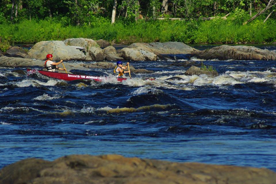
The race began below Indian Island in Old Town. Racers were sent off in heats every 2 minutes by class; ours was the OC-2W class (meaning open canoe- 2 women), the fourth heat of the day. The first rapid, the very spot where Lani and I took a humiliating swim during our first training run, would be only about 400m below the starting line. The entire class of female competitors charged toward the first set of waves, jockeying for position in the fastest water, shortest distance to the first bend in the river, and out of the path of hazards that could slow the pace or put water in the boats. While a few boats broke away from the pack by a couple of boat lengths, the entire pack remained tight and the intensity of race mode was evident in the first few paddle strokes. With two boats on our right side and another immediately in front of us, our plan to run the first rapid near river right was already thwarted. We adjusted to another course and continued through the rapid at a furious pace.


We entered this rapid at the same time as lots of the male OC-1 competitors from
the heats before us. Photo Cheryl Daigle.

The first major rapid would be at the site of the former Great Works dam, about 2 miles downstream. While we hoped to distance ourselves from other boats before the approach into the rapid, instead as we neared the rapid we found ourselves steadily approaching more boats from the men's heat released 2 minutes before ours. Additionally, despite the river being 400 yards wide in places, we found ourselves repeatedly colliding with the black Old Town canoe of Ander Thebaud and Tammy Kelley.  For the most part, I am pretty sure the collisions were inadvertent. Both boats were trying to stay in the fastest moving current while avoiding small obstacles and hazards along the way. As we began to overtake more of the men's boats, however, we found ourselves being pushed into the other crafts by the same black boat, time and time again. After a dozen or more collisions, two of which jammed the pinkie finger of my left hand between the gunnels of both boats, we had all clearly had enough of one another. From here forward, in my mind the black canoe became known as the pinkie-squishing Death Star.**

Other racers navigating Great Works. Photo Tim Nutt


Of all of the major rapids, the Great Works rapid was the longest and most difficult to prepare for, consisting of 3 or 4 drops separated by several holes, large waves, strong eddy lines, cribs and other industrial debris from the former dam. Having run it during our  3 training runs, two things were clear to me- 1) There really isn't a clean, dry line through this rapid, particularly the last drop and 2) The best line down the rapid changes even with small fluctuations in the water level. We paddled furiously toward the rapid in pursuit of the craft of Laurie Spraul and Kathleen Friday, Death Star at our heels, knowing full-well that we would be making decisions on the fly as to how to best negotiate the rapid. While our run through Great Works wasn't completely clean, I resisted my urge to grab onto the gunnels, close my eyes, and scream hoping Lani would paddle me to safety. We maintained our position through the drops while paddling with a quick, strong, clean cadence. In the last drop, we took on a small amount of water from a few large waves requiring some quick attention to bailing before resuming the furious pace set early on by the leaders. Lani and I both gasped for breath from the intensity of the chase, finding ourselves digging deep much earlier in the race than we possibly could have anticipated.
Lining up for the second drop of the Great Works rapid. I think this photo may have been taken on the second day of racing (the Sprint). Photo Tim Nutt.


The next 3 or 4 mile stretch of river was mostly moving water with class I/II whitewater. It was in this stretch where we made our first, and probably only, mistake of the race. Unable to lose the Death Star despite our best efforts, still ramming gunnels (I am pretty sure the men we were overtaking at the time found this pretty entertaining), we seized an opportunity to break off into a channel of water moving down the center of the river while the Death Star chose the flow on river right. With the slightly lower water level from our training run on Wednesday, this proved to be a bad choice. We found ourselves flailing against a swift current rather than being carried by it (not whitewater, just shallow ripples). We emerged a few hundred yards downstream now several boat lengths behind the Death Star. This deficiency we would never make up.

Despite an exhaustive pace, our positions on the river maintained relatively unchanged as we charged downriver toward the class III Basin Mills rapid. Basin Mills is a funny rapid. While short, the consequences of a bad choice are pretty unforgiving. The entry to the rapid consists of a ledge-hole about 100 yards wide in the center of the river (no, 100 yards actually isn't a typo). To the immediate right of the hole, there is a clean line of fast-moving water; however, just below the hole is a nasty, munchy, 6-foot set of curling, frothing, diagonal waves a few feet to the right. While the clean line was wide enough for a boat, an attempt to slide between the hole and the waves would have to be perfect or the consequence would likely be a boat full of water or a swim. During our practice runs, I felt this was the best of all of the options. The idea would be to set up above the waves further to the right than would otherwise seem prudent to ensure our bow was already pointed to the left below the hole. As the waves approached, we would thread the boat between the two hazards.

Here is the MaCKRO arial shot of the Basin Mills rapid. Fro above, it looks pretty small, but for perspective use the trees for reference. Those little ripples are actually big waves! Photo MaCKRO


Probably the hardest thing about the Basin rapid is that from the position on the river, none of the rapid is visible. The enormous ledge pour-over creates a horizon line that almost appears as a low-head dam would. It requires a tremendous amount of trust, commitment, and confidence in whatever approach you choose. As the rapid neared and we dropped to our low position in the boat to allow for better bracing, we were coming in a little further to the left than the from-the-right-approach we had planned. "Where is the freaking hole???" Lani demanded. "Right, further right." I insisted. I attempted to indicate where the hole was, but decided it was best to indicate where I wanted us to go, not where I didn't want us to be. I noted a kayaker further to river right. "Kayaker. The kayaker is on the line we want" I gasped. The Death Star disappeared out of view over the horizon line on river right. Further to the center, the other female boat still in front of us appeared to be headed right for the ledge. While I was certain this was a crazy move, it had also become clear that Laurie and Kathleen were extremely skilled and knew how the river fluctuated at different water levels better than we did. I could see them emerge a few seconds later below the drop, upright, and paddling downstream. If it was possible to run the hole without disaster, I knew it would be faster than the line we planned. It was time to take some risks if we wanted any chance of a place any higher than third.

"Change of plan." I said. "The hole is a better line." I knew Lani could only partially hear what I was yelling through the increasing roar of the river. "Left. Go left now."
"Are you crazy?" Lani hollered. "Honestly Shelley. Normally, I would never do this" she insisted with a very matter-of-fact tone. Not having said no, I knew she was not going to veto me. I continued paddling forward, now driving the boat towards the ledge drop and straightening it out in the final approach. Anyone who knows Lani and I knows this is a complete role reversal. "Oh, Jesus. You'd BETTER paddle hard" she said, hoping to avoid being flipped by the violent hydraulic directly below the ledge. And paddle hard we did. 

We emerged on the other side of what seemed like a black hole upright, dry, and smiling. The kayaker I had referenced just moments before was recirculating in the eddy below out of his kayak. "This totally sucks" he said, waving the rescue boat away to avoid a rescue-disqualification. With a now smaller margin ahead of us, the Death Star was furiously unloading gallons of water. "Let's get out of here" I announced in my best cliche-Hollywood-action-movie-voice. "We've got some boats to catch." 

Here are our friends Fiona and Emmanuel running Basin Mills during a training run. This photo is not race day- Basin is hard for spectators to access and photograph. Fiona Hamilton photo.


Shortly after the Basin rapid, we moved into second place, slowly gaining ground on the Death Star. The final set of drops would be at the site of the former Veazie Dam. During our training runs, we had chosen a conservative sneak-line on the righthand side of the wing dam that remained after removal of the larger dam. We knew this line would likely cost us 20-30 seconds from a more aggressive mid-river line, but circumnavigating the ledges and large wave trains would ensure that we would keep ourselves in the boat and the water out. We weren't in this to show off, we wanted to be smart. With our limited experience paddling against athletes of this caliber, we had never imagined that seconds would matter. 

Long before we arrived at the Veazie rapids, our well-laid plan was scrapped. In a language of broken sentences, gasps, and desperate grunts we agreed that we were headed for the more turbulent waters and ledges of the main flow of water. We'd figure out exactly what that meant as we went along. Unfortunately, only one time had we run the ledge during our first training run; that day we had found ourselves in a communication stalemate forcing the bow to swing out wildly sending us over the final drop backwards. We weren't hoping to repeat that. 
Veazie rapid. There are several canoes in this shot (they
look like little fish) that add a good frame of
reference. photo MaCKRO.

I selected one of the routes I knew other paddlers had used along the left side of the wing dam. Despite the hard, strong paddle strokes that caused my shoulders, back, and quads to ache (? don't ask- I have no idea why) and now beginning to seize up, paddling down the Veazie dam felt more like paddling in molasses than water. "Don't quit" we reminded one another every few strokes. No matter how hard we paddled, how hard we dug, the Death Star just wasn't getting any closer to us. In fact, throughout the rapid they actually appeared to have gained a few seconds on us, despite our more aggressive line and exhaustive paddling. The rapid came and went, as did the remaining quarter mile of river below the final waves and turbulent waters of the final class III whitewater. We laid it all out there on the river. In the end, we came up 24 seconds short.

Or, you could say, we came in 29 seconds ahead of third. Only eight minutes ahead the last boat. In the past, we have done races where a close margin between 2 boats was 10 full minutes. As we swung into the eddy and laid in the boat to catch our breath, it became clear just how awesome this field of ladies had actually been. Nearly all boats in the field were visible in the small section of river that could be seen upstream of the finish line. Never in my life could I have imagined a race could be so close. Or so hard. Or so fun.


Women's second place in the downriver race! Thanks always to Spandits! and Hammer Nutrition for your support for my adventures. Anti-Fatigue Caps and Hammer Gel at the start and Recoverite at the finish was the perfect combination. 


At some point, for those who are actually interested in the stuff, I'll tell you about the Sprint that followed on the next day (the race was just the Great Works rapid). Spoiler alert: we were second again. I know what they say about second place, but I have to say, I couldn't be more excited or feel more accomplished.

**Note- I mean no disrespect when using the term Death Star. In fact, we actually chatted and joked with Ander and Tammy after the race and they both seemed like really nice gals.